Coastal Plan
In order to approach in a coherent manner both the short term and long term developments in the Southwest of Dominica, it is essential to have in place a coastal plan to be used as a reference framework by the community, stakeholders and the government.
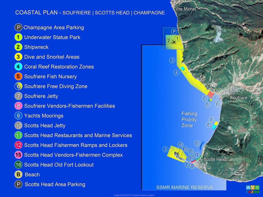
As no extended and comprehensive coastal plan existed for the area from Pointe Michel to Scotts Head, REZDM took the mandate of collecting and assembling into an overall and structured plan the prevailing recovery or development initiatives together with potential future projects envisioned for that entire coastal area. The result of this work is the Coastal Plan presented here.
The Coastal Plan takes into consideration the significant changes to the topology and reduced habitability of the littoral since hurricane Maria as well as the expected increase of activities associated with tourism.
The general objective of the Coastal Plan is to establish or refine specific usage zones that are compatible with the Soufriere Scotts Head Marine Reserve (SSMR) while allowing for a managed and controlled expansion of the touristic activities in the coastal zones of the Southwest of the Island.
The most feasible ideas and projects have been incorporated in the plan, each with an associated physical location, with the purpose of fostering their coexistence in a cohesive manner.
Resilience was a determining factor in the analysis for the location of some of the zones that could be seriously affected by natural disasters.
The Costal Plan is designed to be the foundation for discussions aiming to achieve a consensus between the community and the stakeholders on the overall objectives for the resilient development of the Southwest coast.
The next steps towards further elaboration of the Coastal plan are to continue and extend public and government consultations and expand the plan to include inland areas that can have direct impact on the Coastal zones included in the plan.